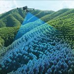
Podem os Drones ser uteis na Topografia, Engenharia e Projeto? Vantagens dos UAV/Drones Os drones permitem voos mais baixos que os aviões tripulados, maior celeridade, menores custos operacionais e ambientais associados e poderá igualmente alcançar um alto nível de detalhe…
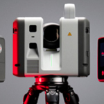
Purchase of the new 3D laser scanners: LEICA RTC700
TOPORIGOR 3D – NEW RTC 700 LASER SCANNERS
It is with great pride that we announce that TopoRigor is celebrating its 25th anniversary
A TopoRigor 3D Geociências- Topografia, Engenharia e Projeto, foi criada a 3 de janeiro do ano 2001, sobre os alicerces de um projeto profissional iniciado no ano 1991 pelo fundador e atual sócio gerente (Engº Paulo Pereira) no âmbito da…
BUSINESS MAGAZINE – TopoRigor 3D Geosciences – Interview 2025
TopoRigor 3D Geosciences ranked amongst the TOP 5% BEST SMEs IN PORTUGAL 2024 for the third consecutive year
https://scoring.pt/empresas/toporigor-3d-geociencias/
TopoRigor 3D Geociências TOP 5% BEST PME PORTUGAL 2023
Attribution of Distinction by SCORING.PT Consolidation and Resilience
TopoRigor 3D Geosciences – AGILE (Organisational Agility Event)
Webinar Participation
TopoRigor 3D Geosciences ranked amongst the TOP 5% BEST SMEs IN PORTUGAL 2022
Attribution of Distinction by SCORING.PT Consolidation and Resilience
What is LIDAR (Light Detection and Ranging) surveying?
What is Cartography?
What does a Surveying Engineer do?
Reality Capture & BIM Engineering
Scan-to-BIM e Produção de Gémeos Digitais (Digital Twins) MULTI-SENSORES — A tecnologia adequada a cada objeto de estudo: Laser Scanners Terrestres, SLAM, Mobile Mapping, UAV LiDAR, Fotogrametria, GNSS e Estações Totais Robotizadas Scan-to-BIM: 100% IN-HOUSE Da captura SCAN ao modelo…