
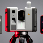
Purchase of the new 3D laser scanners: LEICA RTC700
TOPORIGOR 3D – NEW RTC 700 LASER SCANNERS

It is with great pride that we announce that TopoRigor is celebrating its 25th anniversary
A TopoRigor 3D Geociências- Topografia, Engenharia e Projeto, foi criada a 3 de janeiro do ano 2001, sobre os alicerces de um projeto profissional iniciado no ano 1991 pelo fundador e atual sócio gerente (Engº Paulo Pereira) no âmbito da…

BUSINESS MAGAZINE – TopoRigor 3D Geosciences – Interview 2025
What is BIM?
What is 3D Modeling?
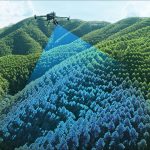
What is LIDAR (Light Detection and Ranging) surveying?
Topography using UAV/Drone
What is a Laser Scanner?

REN – 3D Laser Scanning of Substations in the National Energy Network
Digitalização de Alta Definição – Laser Scanning 3D – Industrial Processo de Engenharia Inversa Laser Scanning 3D + Aéro-Fotogrametria Uav/Drone Com recurso à tecnologia de Laser Scanning 3D de elevada precisão (Leica Scanstation P40 e Leica RTC 360), fotogrametria terrestre…

Reality Capture & BIM Engineering
Scan-to-BIM e Produção de Gémeos Digitais (Digital Twins) MULTI-SENSORES — A tecnologia adequada a cada objeto de estudo: Laser Scanners Terrestres, SLAM, Mobile Mapping, UAV LiDAR, Fotogrametria, GNSS e Estações Totais Robotizadas Scan-to-BIM: 100% IN-HOUSE Da captura SCAN ao modelo…