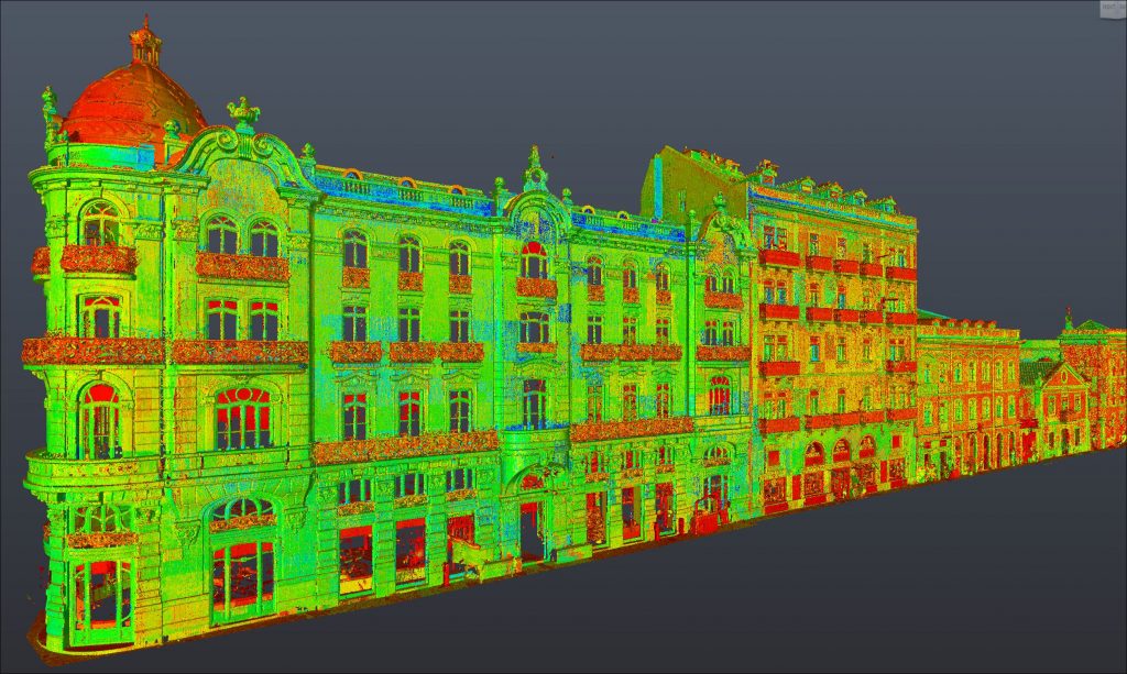

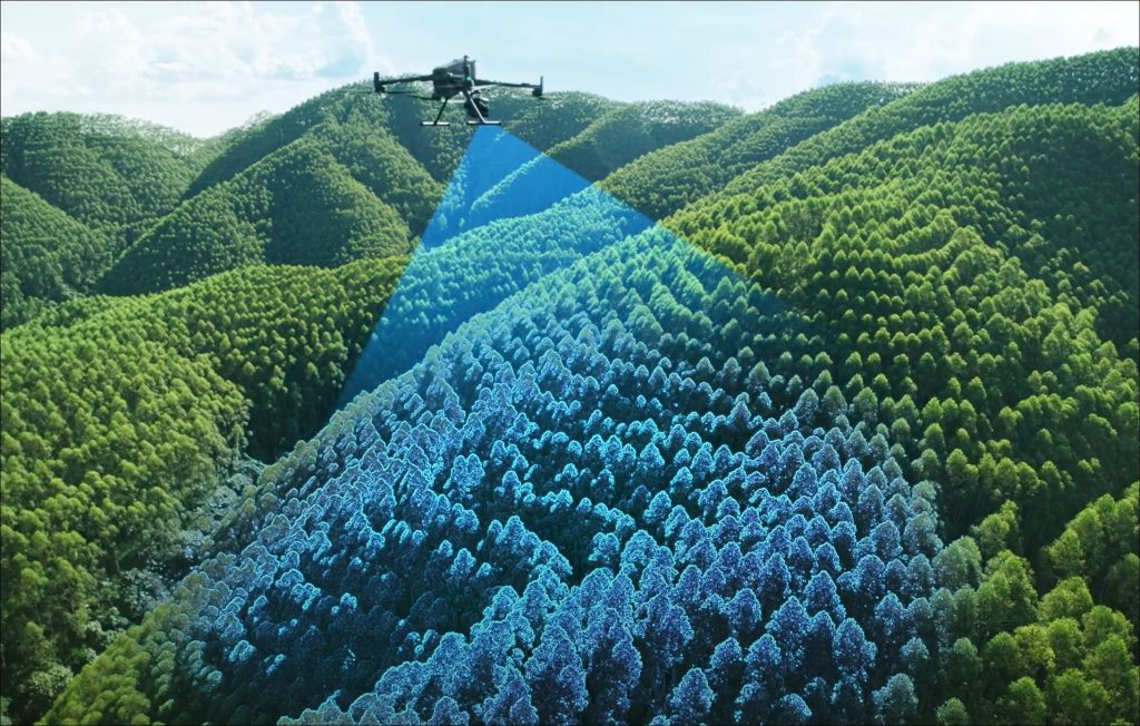
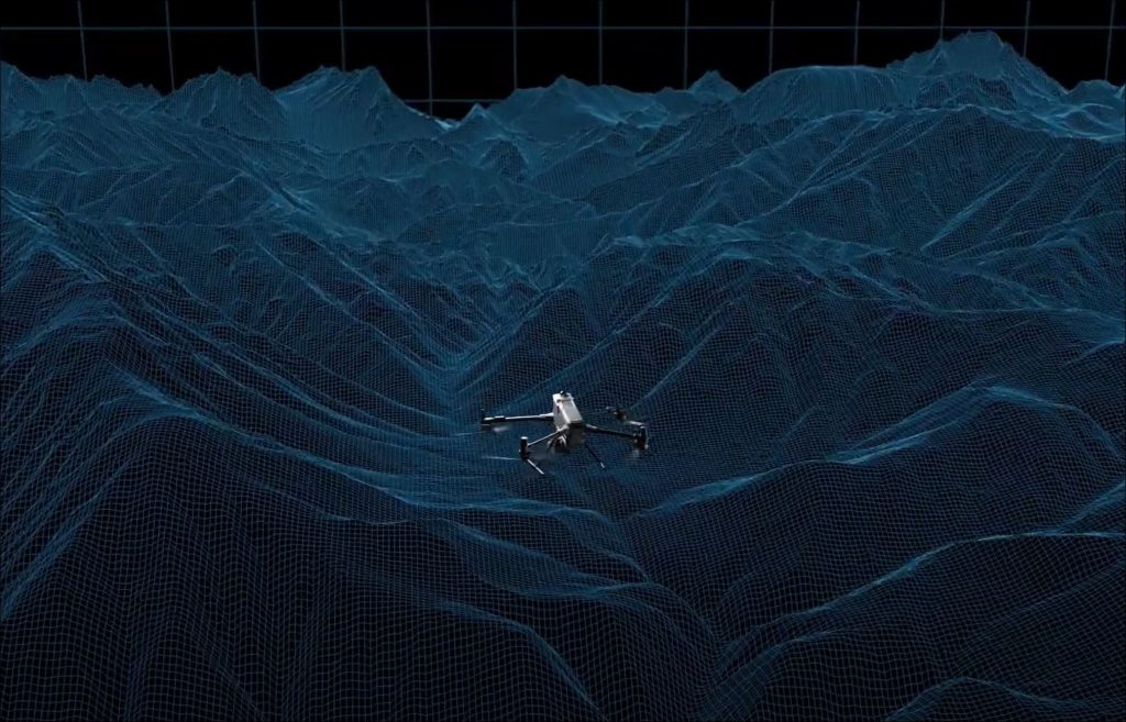
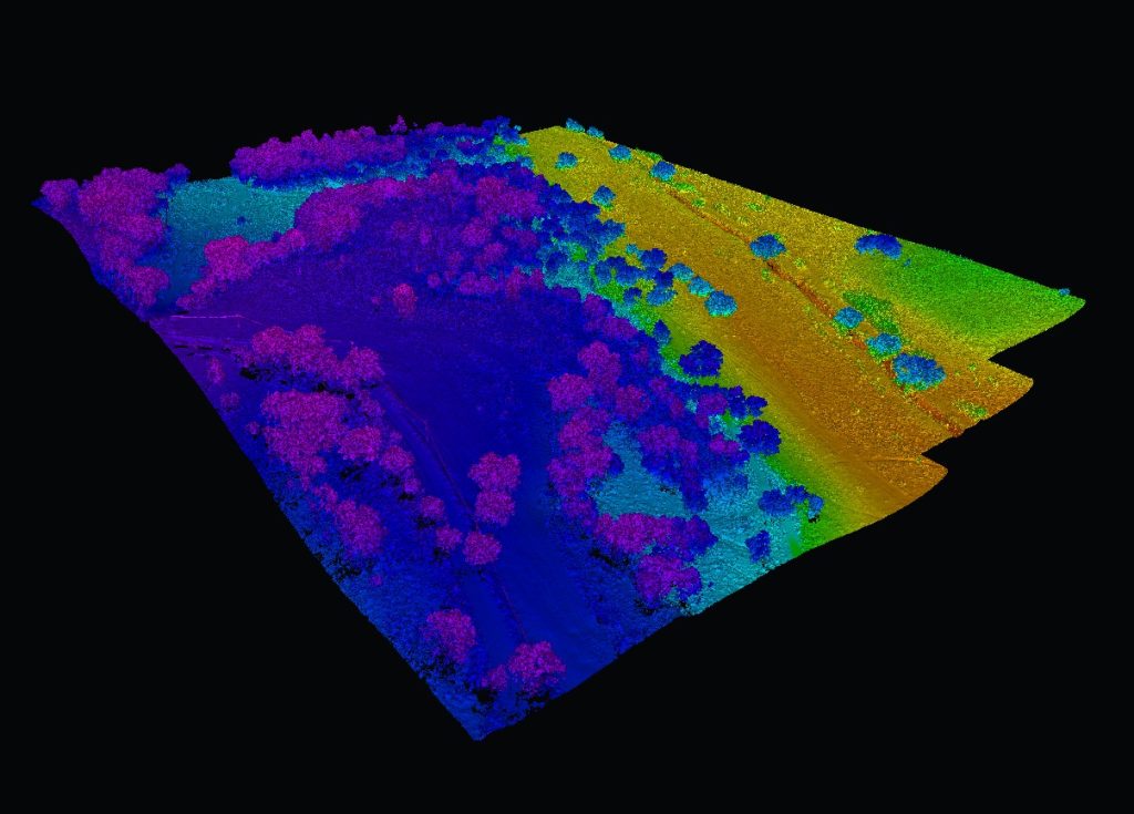
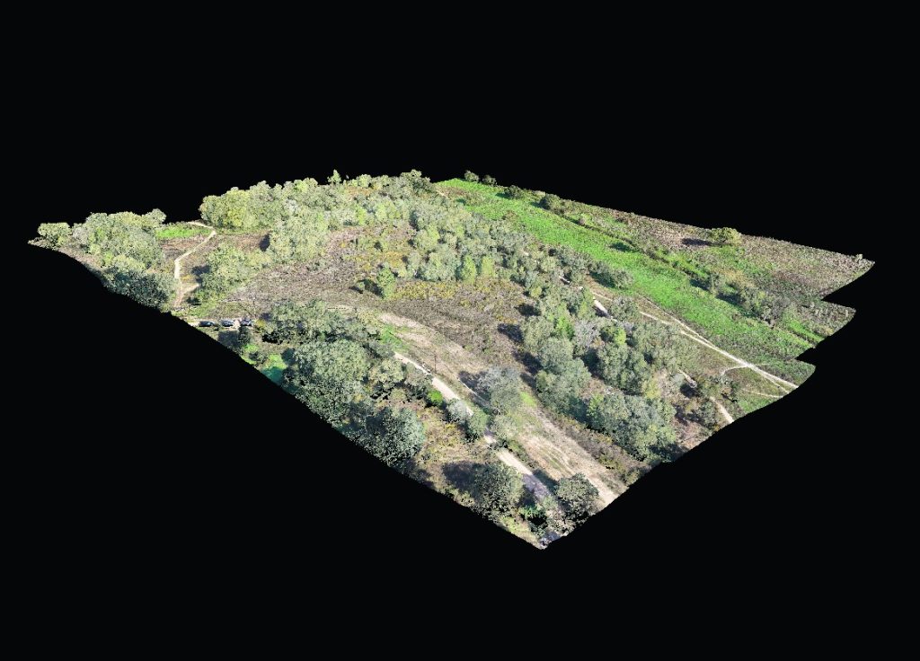
Sensores LIDAR (Nuvens de Pontos 3D) & Fotogrametria Aérea de Alta Resolução (Ortofotomapas – Modelos 3D)
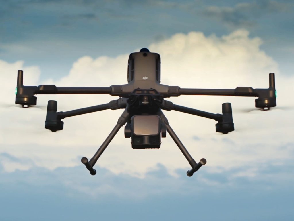
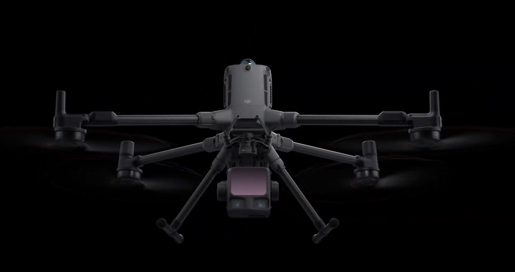
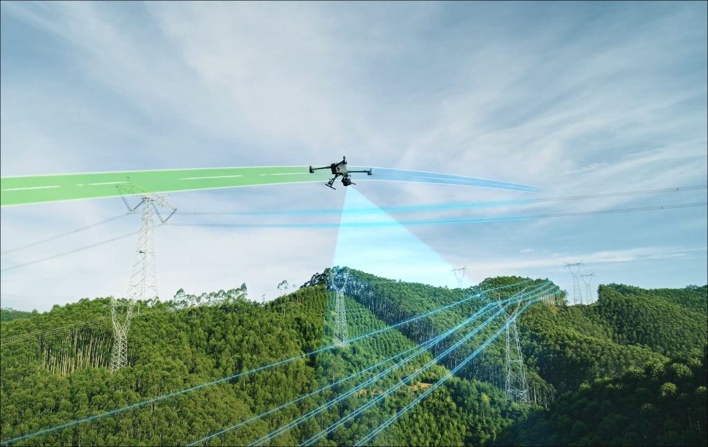
O recurso às aeronaves não tripuladas (UAV/drone), com capacidade para transportar diversos sensores de alta resolução, tais como: LIDAR, Imagem RGB, Infravermelhos, Térmicos, entre outros, é uma tecnologia que já está presente no nosso dia a dia, desde há mais de 15 anos e potenciou a nossa capacidade de produção em diferentes áreas de intervenção, estudo ou projeto.
Em conjunto com todos os outros nossos equipamentos GNSS, Laser Scanning 3D, Estações Totais e poderosos softwares de processamento e edição de dados massivos, permitem-nos produzir resultados diferenciadores, tais como: Nuvens de pontos 3D, Classificação de Informação LIDAR, Modelos Digitais do Terreno, Estudos de Elevações, NDVI, Mapas de Declividades, Mapas de Exposição Solar, Imagem Ortorretificada, Ortofotomapas, Modelos 3D ou BIM de Estatuária, Construções, Monumentos, entre outros.
Before, these techniques were conditioned to the use of satellites or large planes equipped with high-resolution sensors, which despite the excellent results in national and regional processes, make the process very costly and not very agile for local dimension projects.
With the emergence of new technologies and sensors on board UAV/DRONE unmanned aircraft, we can accurately “measure, analyze, study and design” information with high metric quality. This technology has exponentially increased the application and versatility of this type of product.


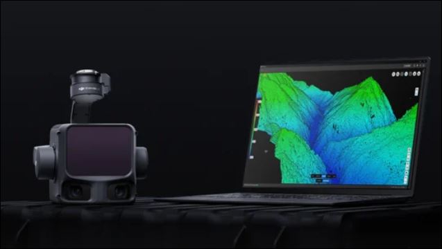
Today we can use Remote Sensing to produce a lot of information in a short time, with high resolution, metric accuracy and with lower costs for the final client. These evidences, raise more and more its potential.
Applications and products: Point clouds, Digital terrain models (DTM), Irregular triangulation meshes (TIN), Mesh, Hydrological studies, Orthophotomaps of urban, agricultural, rural, forest areas, NDVI, Thermal maps, 3D models of objects, monuments and buildings, Historical collections, Rehabilitation and registration of tiles, Area measurement, Volume measurement, Monitoring of deformations or pathologies, among other applications.


By adding the right sensors to your target, we achieve high resolution and add value and potential to your project."
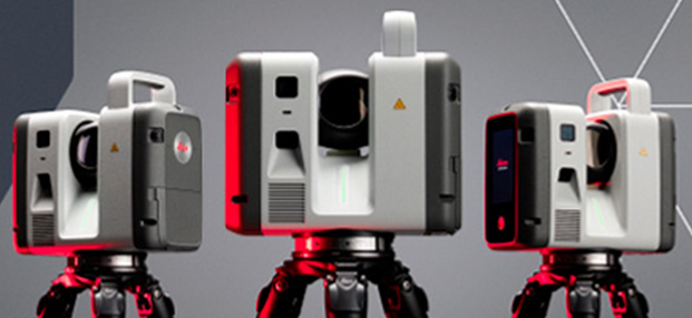
Aquisição dos novos Laser scanner’s: LEICA RTC700 – Contamos com a mais recente tecnologia ao serviço da TopoRigor 3D Geociências.
O rigor e a exatidão continua a ser o nosso principal foco. O melhor da…

3D Laser Scanning
REN - National Energy Networks
High Definition Scanning - 3D Laser Scanning Reverse Engineering Process 3D Laser Scanning …